Big Bend National Park: Easy Trails & Scenic Stops
Plan with current information. Conditions, roads, services, fees, and rules can change. Verify details with the National Park Service before your visit.

Big Bend National Park is a strong choice for a low-mileage day if you plan it as a sequence of views, developed-area pauses, and short out-and-back walks rather than a checklist of long hikes. The scale is the catch: this is Far West Texas, where the desert, mountains, and river country are separated by long drives and summer heat can become serious by late morning. A satisfying easier-paced visit comes from choosing one landscape zone, protecting your energy, and treating every stop as optional until you see the actual surface, weather, and crowd conditions.
Build the day around the drive, not the mileage
At Big Bend, the road is part of the experience—but it is also the part that can quietly consume a day. Distances between towns and services are considerable, and the park’s scenery is spread across desert basins, the Chisos Mountains, and the Rio Grande corridor. Instead of trying to cover every setting in one outing, pick a primary area and use short stops to deepen that one experience.
A lower-effort strategy: arrive with one “must-see” viewpoint or developed-area stop, two short-walk possibilities, and a firm turnaround time. This gives you room to stop when the light is good, rest when the temperature rises, and skip a walk that looks steeper or rougher than expected.
- Desert-focused day: Best for broad views, open light, cactus and geology, and shorter pauses close to your vehicle. Exposure to sun and wind may be the main challenge.
- Mountain-focused day: Potentially cooler than the desert—NPS notes the Chisos Mountains can be 10–15 degrees cooler—but elevation, slopes, stairs, and rapidly changing weather matter more.
- River-corridor-focused day: Good for a different visual rhythm, with canyon scenery and the Rio Grande as the destination. Plan extra driving time and do not assume shade or services will be nearby.
Quick take
For an easy-going Big Bend day, choose one region, park once for a longer rest, and let scenic pullouts plus short walks do the work. Trying to combine desert, mountains, and river country in a single day often turns a relaxed plan into mostly windshield time.
How to choose an “easy” walk without relying on the label
An easy trail on paper is not automatically easy for every traveler. In Big Bend, the key variables are often not distance alone: desert heat, elevation, loose rock, uneven pavement, steps, exposed overlooks, and the walk back to the car can all change the effort level.
Use the official NPS trail and visitor information to assess each specific route before committing. Look for current notes on length, elevation change, surface, closures, parking, water availability, and any accessibility details. Conditions can change after storms, during heat, or because of maintenance, so treat online descriptions as a starting point rather than a guarantee.
Five questions to ask at every trailhead
- What is the real surface? A compact path, paved walk, gravel track, sand, and rocky desert tread can feel completely different at the same distance. If stable footing matters, inspect the first section before leaving the parking area.
- Where does the climbing happen? A short route with a steep opening pitch, switchbacks, or stairs may be more tiring than a longer flat walk. Look beyond total elevation gain and notice whether the return trip requires an uphill finish.
- Is there shade when I need it? Big Bend has abundant sunshine year-round. In exposed desert terrain, a path that feels comfortable at 8 a.m. may be punishing late in the morning during hot months.
- How high am I starting? Mountain areas may feel cooler, but elevation can affect breathing and energy. Slow down, take a short test walk, and make the view from a developed overlook your Plan A if the body says no.
- What is the recovery plan? Know where you will sit, refill water if available, use a restroom if needed, and cool down after the walk. The best short hike is one that does not derail the rest of your day.
Use viewpoints as destinations, not consolation prizes
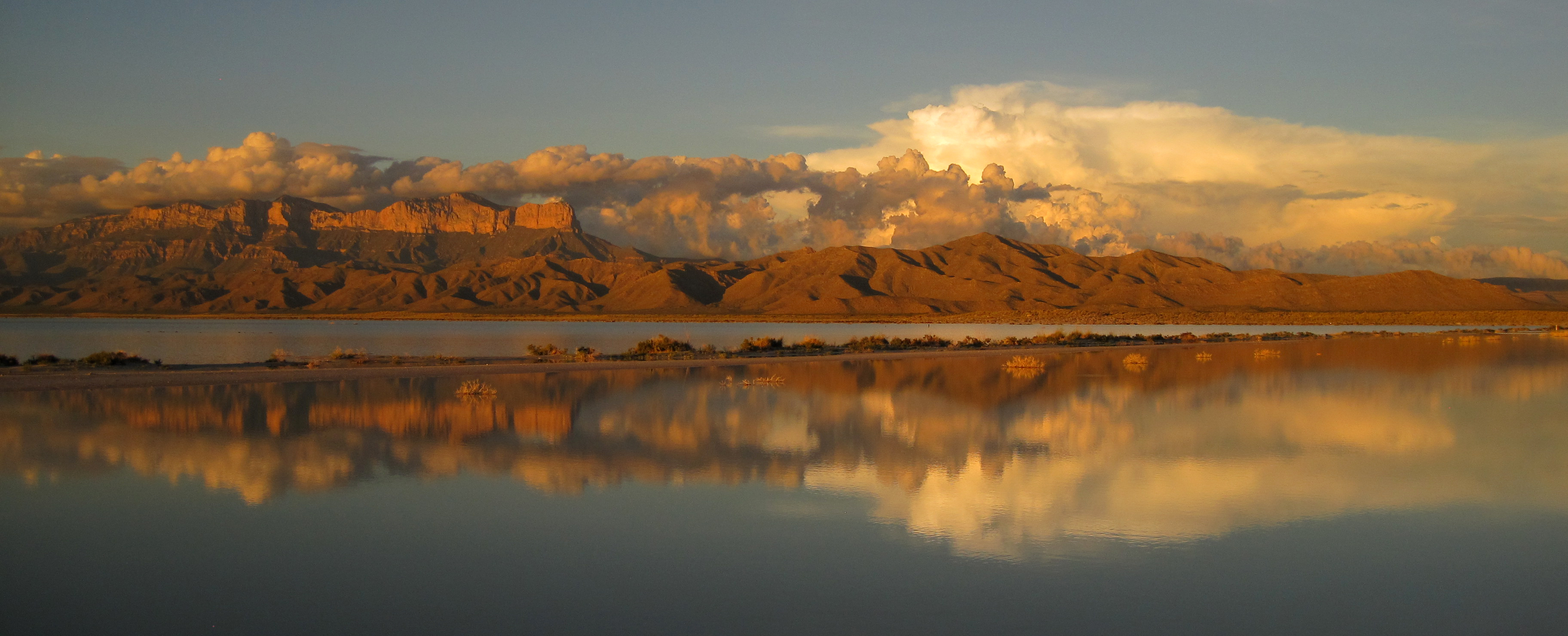
Viewpoints work especially well here because Big Bend’s visual rewards are large-scale: layered desert, weathered landforms, mountain silhouettes, dark skies, and river-cut canyon country. A pullout or developed overlook can offer the kind of scene that would require substantial mileage in a more forested park.
Give each scenic stop a purpose. One can be your sunrise or early-light stop, another a leg-stretch stop, and another a place to sit with snacks rather than rush onward. This approach reduces the temptation to turn every parking area into a hike.
- At the car: Take two minutes to check wind, temperature, footing, and how everyone is feeling before deciding whether to walk farther.
- At the viewpoint: Look for a bench, wall, or stable place to pause, but do not rely on seating being available. Bring a light layer for wind and a hat for exposed stops.
- On short walks: Turn around while the outing still feels easy. The photo does not need to be at the official endpoint to be worthwhile.
- On the drive out: Save one scenic stop for later light if your schedule allows. It gives the day a graceful ending without adding a demanding final hike.
Plan around heat, light, and recovery time
Big Bend is in the Chihuahuan Desert, and NPS warns that summer heat begins in May; May through August are the hottest months. Desert temperatures are usually well above 100 degrees F by late morning in summer, while spring—especially March—is typically warm and pleasant but also the park’s busiest season. Fall and winter are generally mild and pleasant, though freezing conditions can occur.
| Timing | Easy-stop advantage | Planning tradeoff |
|---|---|---|
| Early morning | Cooler conditions and softer light for exposed overlooks. | Requires a prompt start and careful driving in low light. |
| Midday | Best used for a seated meal, visitor information, or a very brief developed-area stop. | Heat and exposure can sharply reduce walking comfort. |
| Late afternoon | Often a good window for one final short walk after a rest. | Leave enough time to return safely; road distances are substantial. |
Rest is an itinerary item here, not dead time. Plan a real break after the day’s most exposed stop: sit in shade if you can find it, eat something salty as well as sweet, drink water steadily, and reassess whether the second walk still sounds pleasant. In hot weather, shortening the walking portion may be the most skillful choice you make.
Quick take
In summer, make the first hours of the day your walking window. By late morning, prioritize air-conditioned driving where available, shaded rest, fluids, and scenic stops that do not require a long exposed approach.
Accessibility: verify the route, not just the destination
Big Bend’s developed areas can make lower-effort sightseeing more realistic, but accessibility needs are specific to the individual route and can be affected by surface condition, grade, curbs, parking layout, restrooms, and temporary closures. Do not assume that a short path, overlook, or visitor area is accessible simply because it is close to a road.
Before leaving for the park, check the official NPS Big Bend page for current accessibility information and contact the park directly if you need details that are not listed. Ask practical questions: Is there a designated accessible parking space? What is the surface from the parking area to the viewpoint? Are there steep grades, stairs, narrow sections, or loose material? Is an accessible restroom available at that stop?
- Mobility devices: Confirm route width, grade, surface, and any barriers for the exact destination you hope to visit.
- Limited standing tolerance: Favor stops where the view begins close to the vehicle, and bring a portable seating option if appropriate for your needs.
- Heat sensitivity: Ask about shade and indoor visitor facilities, but carry your own water and cooling plan rather than depending on them.
- Hearing or vision needs: Check current NPS information for interpretive formats and site-specific features before travel.
A relaxed one-day rhythm for Big Bend
This sample is intentionally a framework rather than a named-route prescription. It works best for travelers who want scenery and a little walking without turning the day into an endurance event.
- Start early with one scenic drive segment. Choose the area closest to your lodging or entry direction, fill the vehicle before entering remote stretches, and begin with a viewpoint or developed stop rather than a long trail.
- Add one short walk while temperatures are friendliest. Select it only after checking the trailhead surface, grade, and your group’s energy. Make a turnaround point before you begin.
- Take a full midday reset. Eat, hydrate, use available facilities, and spend more time driving or viewing than walking during the hottest part of the day.
- Choose one second-stop option. If everyone feels good, take another brief walk in a different landscape. If not, substitute a scenic pullout or developed overlook and keep the day enjoyable.
- Leave with margin. Big Bend is remote, and NPS emphasizes carrying plenty of gas, food, water, and supplies. There are no electric vehicle charging stations in the park; the closest charging station is 130 miles away in Fort Stockton.
The most memorable easy day at Big Bend National Park may involve fewer trail miles than expected. Let the desert light, mountain relief, canyon views, and spacious pauses set the pace. When you plan for distance, heat, and recovery as carefully as you plan for scenery, the park feels expansive rather than exhausting.
Before you go
- Review official alerts, closures, hours, and reservation requirements.
- Allow extra travel time and keep an alternate plan.
- Use official NPS information as the final authority.
Sources
- Big Bend National Park — official National Park Service site — National Park Service, accessed 2026-10-29
Continue planning Big Bend
Learn more about Big Bend and find other helpful guides, trails, and trip information in the ParkQwest guide.
ParkQwest is a QwestLyfe Community.
QwestLyfe helps you track your lifelong bucket lists, collections, recipes, and the places you've been. Document your experiences, add notes and pictures, and share them with your friends — and the world.